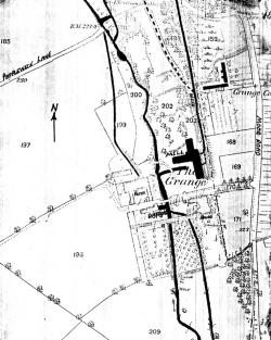
 This is an extract from the 1882 edition OS 25″:1 mile County Series plan of the Grange Mill site, south of Papplewick lane and west of Moor Road (it comes from Sheet 33.5/33.9). It has been labelled to show the sites of some of the mill buildings, cottages and leats, superimposed in black.